Contour lines are an essential part of understanding the terrain shown on a map.
In this beginner's guide, we'll learn how to interpret contour lines and what those squiggly lines actually mean.
Section 1: Understanding Contour Lines
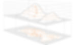
Contour lines are curved lines on a map that connect points of equal elevation. They help us visualize the shape of the land, including mountains, valleys, and hills. By reading these lines, you can determine the steepness of slopes and identify potential obstacles or landmarks.
Section 2: Key Concepts
a. Contour Interval: Contour lines are drawn at regular intervals, with each line representing a specific change in elevation. For example, this could be at 5 or 10 metre intervals. The best place to find out this info is by looking at the key/legend on your map. Alternatively, if you follow the contour lines around eventually you will see some numbers next to them. This will tell you the elevation.
b. Index Contour Lines: Index contour lines are thicker or labelled with their elevation. They typically appear at regular intervals, such as every fifth or tenth line, and help you quickly identify the elevation of a given area.
Section 3: Reading Contour Lines
a. Contour Line Patterns: Contour lines form distinct patterns that reveal the shape of the land:
V-Shaped Contours: V-shaped contours occur where rivers or valleys cut through the landscape. The V points uphill, indicating higher elevations in that direction.
Concentric Circles: These contours depict a hilltop or a basin. The circles become smaller or larger as you move towards or away from the center, respectively.
b. Gradient and Spacing: The spacing between contour lines indicates the steepness of the slope. When lines are closer together, it suggests a steep gradient, whereas widely spaced lines represent gentle slopes.


Section 4: Putting It Into Practice:
As with any map reading skills the best thing to do is practice. Try to get out on a clear day. Look at the map first and then visualise what you think the terrain will look like and see if it is what you expected.
Spot the patterns in the shapes. What are the shapes that you see on the ridges, the hills and valleys. Once you have got those patterns nailed down you will start to identify even smaller features.

Conclusion:
Contours are one of those things that can seem intimidating at first and easily neglected when map reading. Opting for more obvious features like following a path. However, once you become more familiar with them, you soon realise how accurate and reliable they can be. Most experienced navigators will tell you that when they are trying to find clues to where they are, they will always use contours as one of those features.